Mount Greylock is not only the highest mountain in the Commonwealth of Massachusetts at nearly 3500 feet, but it also boasts several interesting slides worth checking out. My buddy Jim has always wanted to check out the impressive 1990 slide that scars the east side of the mountain, so we decided that today would be the day. We parked in Greylock Glen at the barriers on Thiel Road, starting from an elevation of only 1180 feet. A short walk up into open meadow provides an outstanding view of Greylock and its slide, as well as the powerline cut out that runs up another, older slide from 1901.
We wandered through Greylock Glen, making our way over to the base of the Thunderbolt Trail, which is the steepest route up the mountain. Snow was patchy at this elevation, with some deeper pockets in the shade.
The Thunderbolt Ski Trail was built all the way back in 1934 by the Civilian Conservation Corps, and the trail saw its heyday back in the 30's and 40's. Today, the trail is still skied and hiked quite often, but decades of neglect have also left remnants of the past scattered about in the woods.
The east side of Greylock is extremely steep, with snow covered drainages cutting down the steep slopes.
Cool but comfortable temps and bluebird skies made for fantastic conditions. We used spikes, but were barely needed on the crusty snow.
One of the nice parts about hiking the Thunderbolt Trail is that you gain elevation very quickly, with views behind you to the valley opening quickly. At about 2800 feet, we decided to the leave the trail and bushwhack towards where we believed the slide was.
After a half mile bushwhack through deep snow, we emerged at the base of the slide. We had to be very careful with the snow breaking away beneath our feet on the steep slopes, but we made our way as carefully as we could to the open rock.
We were both extremely impressed at the sheer magnitude of this slide, as it stretched upward over 200 feet almost vertical. With warm temps and melting snow, we decided not to push it any further, and we turned back here.
The bushwhack back to the trail was all side hill, with steep pitches making it a slow go. Occasionally we would sink in almost up to our waist in snow too, so we really took our time here.
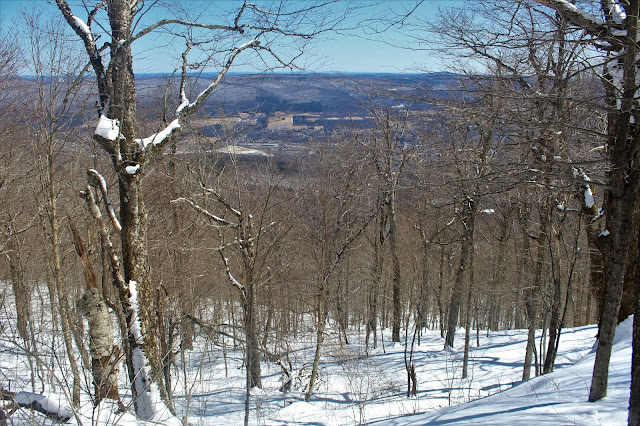
The slopes beneath us on the bushwhack were quite steep, offering glimpses all the way down to the valley below.
Once back to the trail, a steady, steep drop brought us back down to the Bellows Pipe Trail at about 2000 feet of elevation. We followed this trail north, eventually meeting up with the Ragged Mountain Trail, which brought us steeply up to that summit. While it may be looking like spring in the valley, the slopes just below Ragged's summit were completely engrossed in winter conditions.
From just off the 2517 foot summit of Ragged Mountain, we enjoyed the spectacular view of Greylock and its slide. Although I've done this peak several times, this was Jim's first visit here and he was impressed.
A zoom view towards the summit, with the summit road running just below it, Between 2800 feet and roughly 3100 feet is the Indian Head slide, which we had just been to.
Jim continued on to Raven Rocks and Ragged's other summit bumps, but having visited them before, I opted to turn back. I bushwhacked straight down off Ragged through melting snow and muddy conditions. All of the drainages are running impressively, especially below 2000 feet.
Once near the base of the mountain, I was welcomed back into spring conditions. The deep snow from up high was all running water way down here.
A nice, full 7 mile hike through snow up high and mud down low. Over 2300 feet of ascent for the day.
The apple orchard just below Greylcok Glen provided its own fantastic views east towards the Hossac Range as I began my ride home, completing another great day out in the woods.


No comments:
Post a Comment