With a small window of time this morning, I headed east to re-climb 2139 foot Lenox Mountain on an overcast, cool late winter day. There are several different routes you can take up Lenox, but the one I would be using today is via a fire access road from the end of Osceola Road near the Lenox/ Richmond town line(elevation 1620 feet). The access road was mostly covered in ice, but footing wasn't too bad with the exception of only a few random spots as I made my way north. I ended carrying my spikes the whole time , not needing them at all.
After a quick, steep push up through dark hemlocks, I emerged at the open 2139 foot summit area, complete with unsightly radio and cell towers.
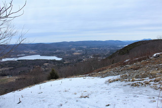
Just below the summit tower is a wide open view that stretches from the SW to the NW. This is the view NW, towards Pittsfield. Richmond Pond is the body of water in the foreground, with a corner of Onota Lake poking out beyond Yokun Seat(the northern ridge of Lenox Mountain). The multiple peaks of the Pittsfield State Forest make up the ridgeline running north to south.
To the SW, the view stretches all the way towards the distant Catskills, which can be seen on the distant horizon. Visibility was just good enough to allow them to be seen today.
Always love this spot! A great view northwest over Richmond Pond and towards the Taconics. The cleft in the ridgeline is where Route 20 passes through on its way into NY.
A zoom view down towards Richmond Pond, still mostly frozen, with Route 41 and the large Interprint facility just west. A careful eye can even pick out the Shaker Village near the Route 20/41 junction, as well as the solar panels in the shadow of Shaker Mountain.
A nice and easy return hike along the access road got me back to the car in no time. About 2.8 miles RT with 530 feet of ascent on a cold March morning.


No comments:
Post a Comment