Been looking forward to getting out and spending the day together with my dad and brother for quite a while now. Our original plan was to hike the Saratoga National Historic Park, but due to the government shutdown, the park too was shut down. This proved to be nothing more than a mere speed bump because there are so many other options out there. Another brilliant fall day was in the cards, so we headed to the Adirondacks. We were looking for something a few miles long but not too challenging, so we settled on Stony Pond in the town of Minerva. My dad had been there several years ago, but it would be a first for my brother and I. The trail is 4 miles RT, but mostly level through a beautiful forest, leading to a large pond with a lean to.
Found this very interesting. The tree is literally growing around the large boulder.
A short side trail leads to the quaint Twenty Ninth Pond. This side of the pond is state owned, but the other side is private with a boat house.
Found this little guy camouflaged along the trail.
The two mile hike in went quickly with company and conversation along the trail. When we got to the pond, it was simply stunning. We were all taken back by the view across the pond and the foliage surrounding it. The lean to was appropriately placed near the shoreline, affording beautiful scenery.

My brother Stephen ambles in for a closer look at the crystal blue waters.
Outstanding foliage.
There were several canoes of different size near the lean to, as well as ores hanging inside the lean to. This would certainly be a great spot for a paddle.
View back to the lean to from the west shoreline.
Fall foliage on the hillsides.
Looking out from the lean to. A nice fire pit, picnic table and views leave little to be desired.
Packing up and moving on.
Stony Pond. Very impressive!
We then headed over to Moose Pond Club Road for a short walk on the old, abandoned railroad tracks for a quick peak at Vanderwhacker Brook and the Boreas River.
Vanderwhacker Brook where it crosses Moose Pond Club Rd.
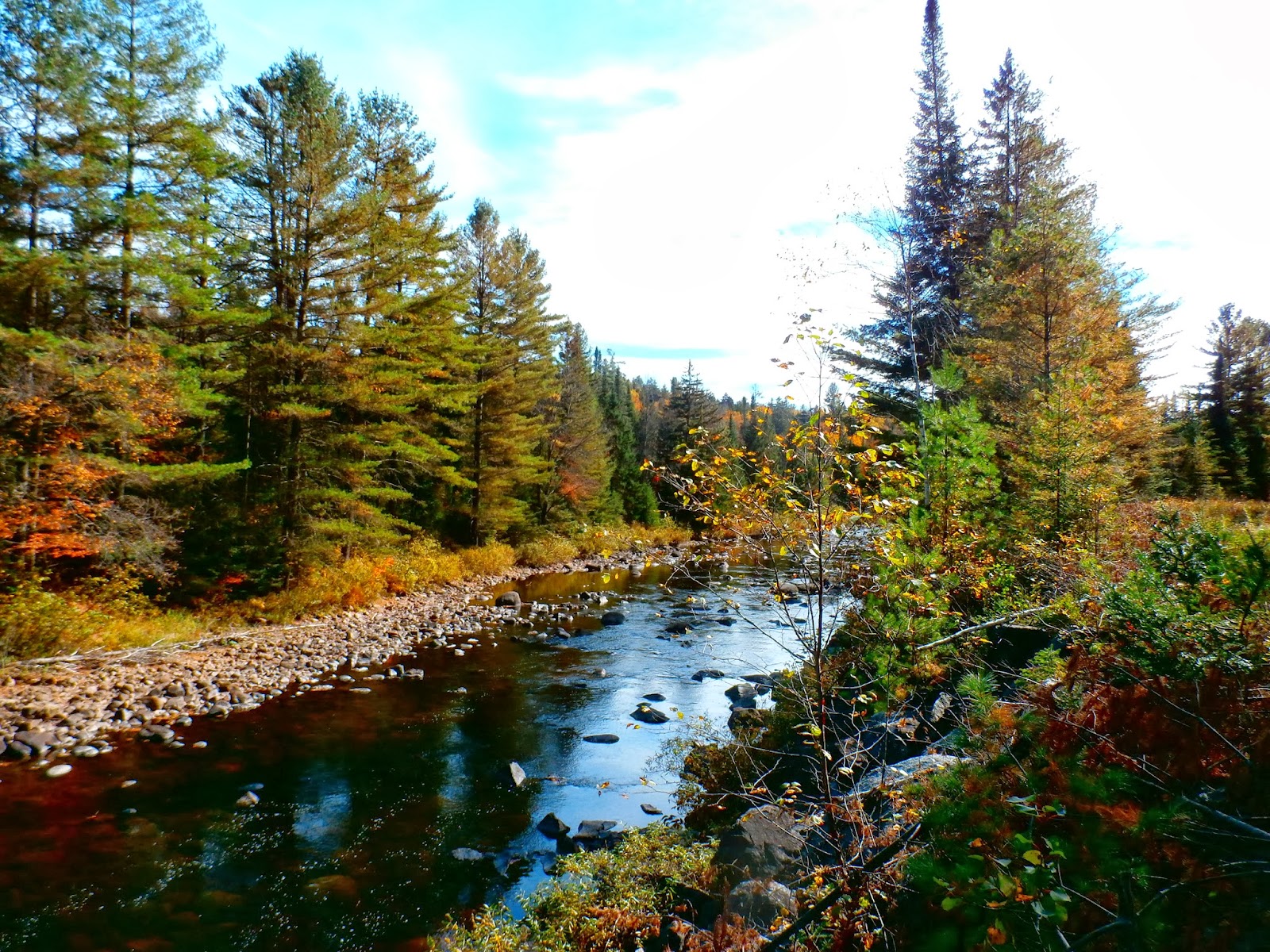
The Boreas River.
The old rail line.
To cap off the day, we drove down to the Siamese Ponds Wilderness Area to walk the shores of Thirteenth Lake. It is a large lake at nearly two miles, and while a popular lake to visit, the remoteness of the area lends itself to peaceful solitude. There are several miles of hiking trails around the lake and mountains around it. The lake is also reputed to be a great spot for fishing.
There are no words.
We only walked the trail along the shore for about a half mile and then returned, but the views were unbelievable. Priceless.


Hey Walking Man,
ReplyDeleteCould I have your permission to use one of your photos (Vanderwhacker Cr) in a (non-commercial) article on water pollution where I show data from Vanderwhacker Cr? I would acknowledge you however you wish - by name or by blog handle. Beautiful photos and I enjoyed ambling through some of your travels. I'm jealous. We don't have trees in Idaho.
Chris Mebane, Boise cmebane@usgs.gov
No problem at all, I appreciate you asking. Glad you enjoyed the blog too. You can simply use the blog handle if you'd like. Thanks!
DeleteThanks much. Keep ambling!
ReplyDeleteChris
This is where I grew up. Nice pix!
ReplyDelete